community mapping and environmental scanning

Considering that the homeless people are the key players in building their lives and addressing their concerns, they are already part of the whole process in the projects they themselves have initiated. The organizations networked in the Philippine Alliance provide them the technical training and skills for this.

Development and use of alternative tools and approaches in data gathering and management.

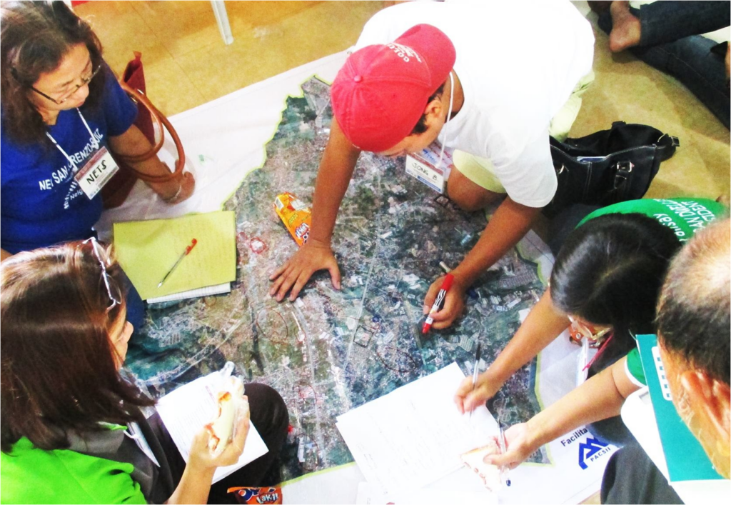
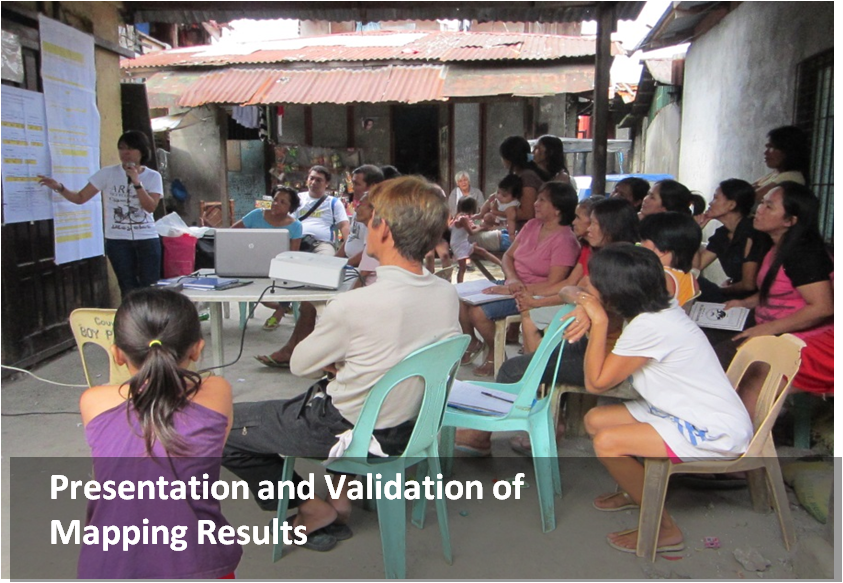
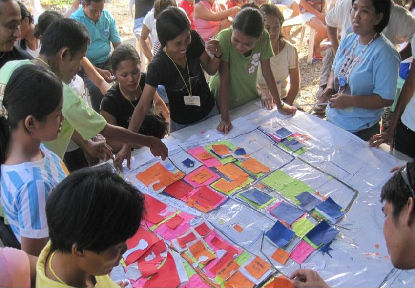
Community Mapping: Also referred to as Public Participatory Geographic Information System (PPGIS), community mapping is an essential component in community development. It is meant to help people understand better their locality in terms of its physical and social conditions. The HPFPI, mentored by its partner organizations in the Philippine Alliance, becomes the key actors in this community-led initiative in trying to identify the resources, key structures and buildings, topology, soil condition, and hazards as well as the dynamic social forces present in their community. This has been done in many different cities in the different parts of the country for the development of existing communities. Mapping is basically anchored in five basic strategies: (1) Building initial commitments among the stakeholders (courtesy calls, general assembly of HOAs, signing of memorandum of agreements, etc.); (2) Transfer of Knowledge to communities through training on basic concepts and processes; (3) Information Gathering using maps, survey forms for community profiling for statistical and demographic data, interviews and focus group discussions for historical and narrative data; (4) Validation and Information Management, using situational analysis matrix, quadrant system for prioritization in identifying needs and allocating resources; (5) Mobilization and Follow-up based on the gathered data in addressing community issues and problems, in lobbying for support from government and other institutions, for negotiations with other stakeholders. To ensure success in this effort and good impacts to the community, in 2015 the Philippine Alliance adopted the Social Tenure Domain Model which is pro-poor, gender-sensitive, participatory land information recording tool as its database for all its mapping activities for easy encoding and management of data (see Video presentation produced by the Philippine Alliance, 2017)

Environmental Scanning: For any organization to be successful, it is important that it regularly scans its environment, identifying the factors that contribute to its life, functioning, and development. Such scanning involves monitoring of both the internal as well as the external environments, of threats and opportunities, of challenges and risks and how they affect or impact to the organization. The information or data gathered becomes useful in decision-making especially in terms of coming up with strategic plans for the organization.                                                                                            

Disaster Risk Reduction and Management: One area where both community-mapping and environmental scanning become most useful is in the community’s disaster risk reduction and management. The reality of climate change and global warming has given rise to a lot of disasters to which many communities, especially of the poor, are subjected to. The task of managing and reducing such risks and disasters, therefore, becomes an important component in community development. The community should have a way to check and correct structures that are vulnerable to disasters. It is about protecting or relocating people from danger zones or hazardous areas. It also means ensuring the readiness of the communities to mitigate the impacts of disasters, like typhoons, earthquakes, tsunamis, or fire. Most recently, it includes the high level of risks brought about by epidemic or pandemic crisis like the COVID 19, for which nobody seemed to be ready and prepared to deal with.